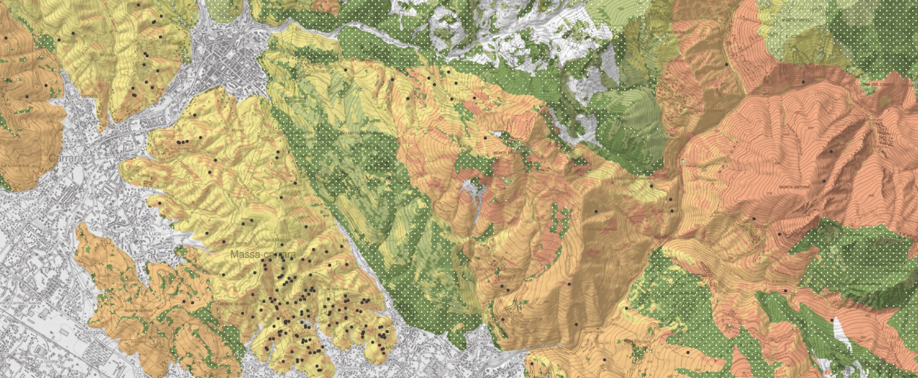
Progetto CARG: il nuovo foglio di Pericolosità Geologica n. 249 “Massa-Carrara”
Nell’ambito del Progetto CARG, che prevede la realizzazione e informatizzazione della Nuova Carta Geologica e Geotematica d’Italia alla scala 1:50.
Nell’ambito del Progetto CARG, che prevede la realizzazione e informatizzazione della Nuova Carta Geologica e Geotematica d’Italia alla scala 1:50.
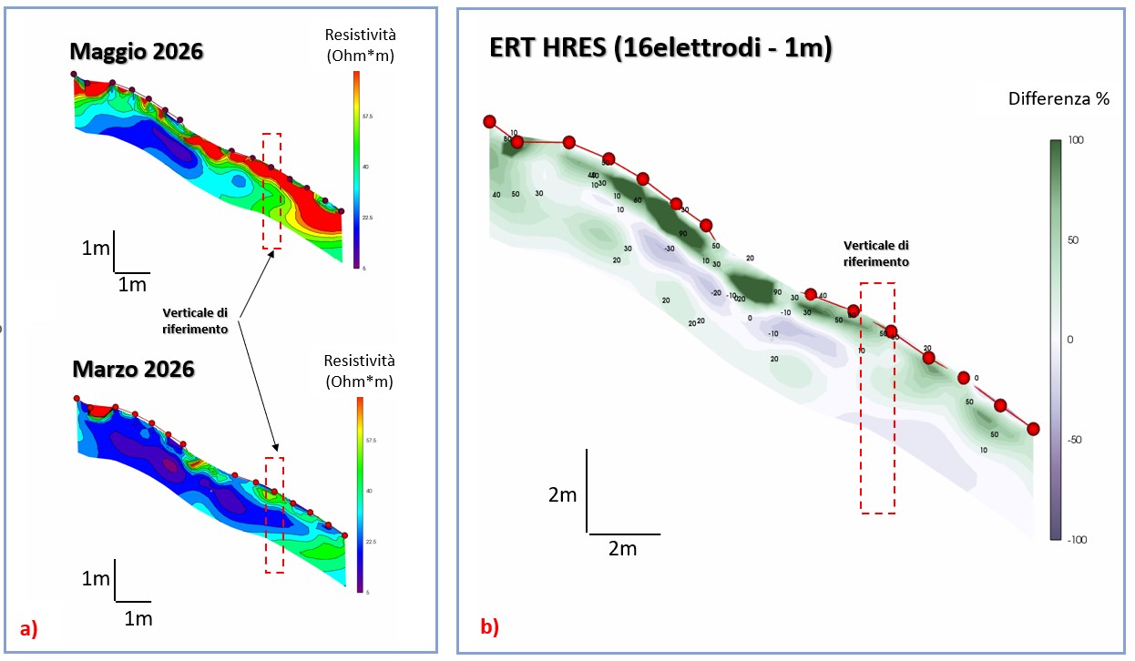
Il monitoraggio dei versanti attraverso misure geofisiche rappresenta da molti anni un importante supporto ai metodi convenzionali di monitoraggio per la prevenzione dei rischi ambientali ed idrogeologici, con particolare riguardo alle frane in terreni sciolti.
IMPEL (European Network for the Implementation and Enforcement of Environmental Law) è la rete europea che dal 1992 riunisce le autorità ambientali degli Stati membri UE e dei paesi candidati o associati.